Geographical Information Systems
URL : Online Street Directory
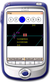
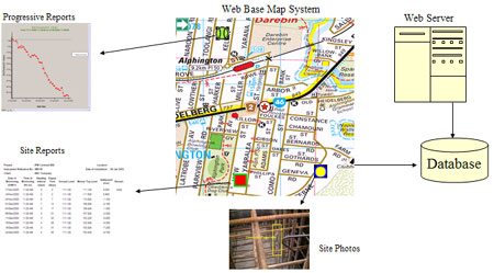
We have been deploying the solution of geographical information system (GIS) with integration into other applications. The GIS has two platforms, one for the web applications and another one for PDA application.
Key Features
- Organize and group the data sets
- Spatial analysis for decision making
- Display layers of information systematically
- The database in the web base GIS is syncronize with PDA GIS database.
GIS Benefits
- Locate the data easily
- Saving times and costs on preparing same sets of information
- Effective biased-sampling
- User can view acquired data with the GIS easily
- helps to identify presented information
Overview
Various of informations are hyperlinked on the map in the GIS system
The Pocket PC map